You develop a new common sense when living in China long enough. I call it communist sense.
I came to China as a researcher and got promoted to professor in 2019 (“Assistant Professor” as my wife keeps pointing out, not to be confused with a “Professor’s assistant” though!). I left Peking University in 2022, but my profile is still online (here).
Freedom-to-teach
I was teaching Machine Learning to students of earth and environmental sciences. It was an amazing opportunity, especially because Peking University is China’s top university and has some of the brightest students in the world studying there. It’s like Oxford or Harvard, but in China. I developed a whole class that I am very proud of, teaching various different machine learning tools with various different earth and environmental science applications. Students would learn things like using neural networks to study volcano eruptions, they would use random forest classifiers to predict earthquakes and they would use logistic regressions to study climate change.
I was given a lot of freedom on what to teach and how to teach it. But you have to use common sense. Or rather: communist sense. Let me explain.
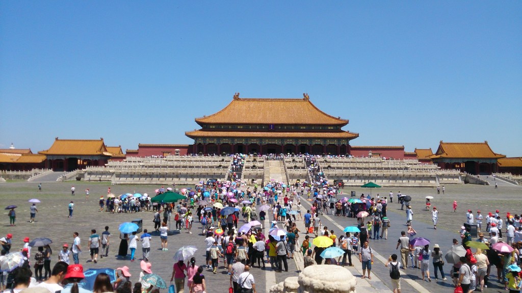
One example I used in class was using a support vector machine (never mind what that is!) to identify land use on satellite images. What this means is that city planners, governments, the agricultural industry, etc, look at maps to see which parts of the lands are used for agriculture, which parts are built up by cities, which parts are covered by lakes or forests or wastelands etc, to plan where to build what. These sort of maps come from satellite images, so you need to have a system that can figure out how the land is being used. Roughly speaking, green areas are covered by vegetation, blue areas by water, and grey areas by cities, of course, but it’s not quite as straight-forward as that (green could be a forest, a farm, or a green roof). This is what I was teaching the students, and as an example, I used a satellite image of Beijing.
I sometimes thought of using another example (not seriously of course), which would have been much more educational for the students for other reasons: The South China Sea.
South China Sea propaganda museum
Much of the South China Sea is of course disputed territory between China, Vietnam, Philippines, Brunei, Indonesia, Malaysia and Taiwan. China claims all of it. On the southern Chinese island of Hainan (this one is actually Chinese, and it is beautiful), there is a South China Sea propaganda museum that I visited once. It was an experience to say the least.
Most amusing, in my opinion, was this picture of a proud Chinese explorer who claimed ownership of a tiny rock in the sea that was barely large enough for him to stand on by heroically setting up a red Chinese flag. Take that, Columbus!
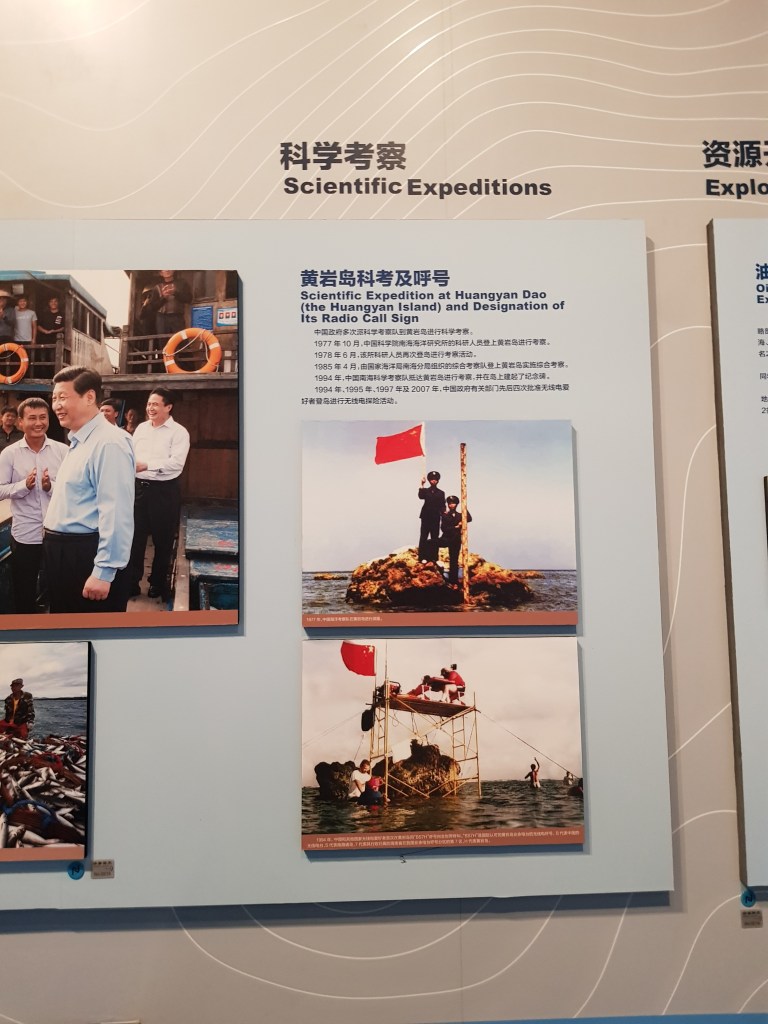
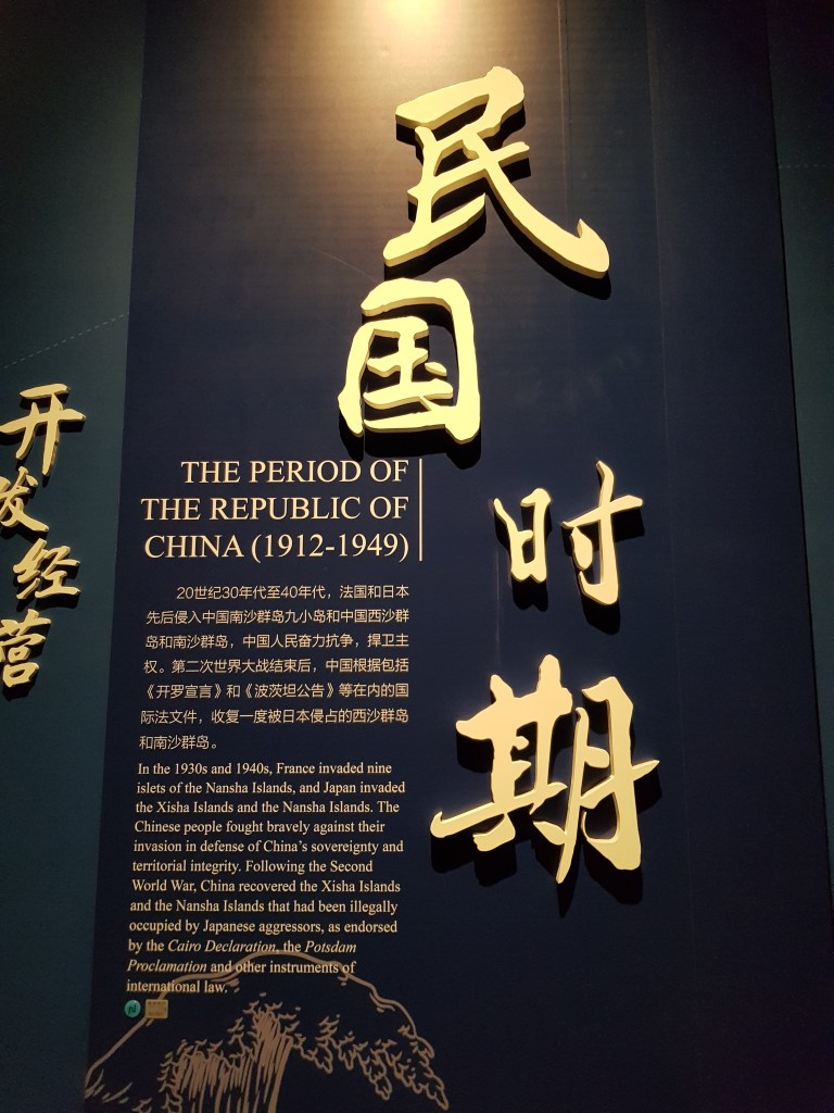
This picture was paired with a photo of the Chinese president supposedly to make him look equally heroic for defending these sorts of rocks from foreign adversaries like France and Japan. Another sign explained how these “aggressors” invaded the Nansha islands (which are partially in the Philippine exclusive economic zone).
No word about the controversy. Educational this museum was not.
My visit to the museum was about halfway through my stay in China, when my communist sense was still gradually developing. Hence, I took out my phone and looked up some of the islands mentioned in the museum on the map.
Google Maps is blocked in China, only the Chinese equivalent Baidu Maps is accessible. This is because Google Maps “misrepresents” the map, according to the Chinese Communist Party’s view. Below you can see the difference:
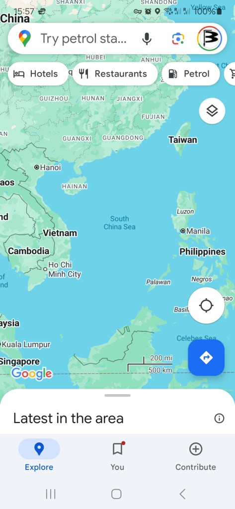

All maps shown anywhere in China must show the “nine-dash line“, which indicates that all of the South China Sea belongs to China. Yes, there is a law that stipulates this. Baidu Maps additionally marks the individual “islands” that China claims.
I was young and naïve and my communist sense wasn’t developed very well at the time, so I pulled out my phone, zoomed in on some of the islands and saw… nothing. In many cases there is just sea. Many of the islands are so small and are actually underwater during hightide that you cannot see them on the satellite map. All you can see is the red lines that are overlain by Baidu Maps. I turned round to my parents-in-law (assuming they would be well aware of the international dispute and the equally ridiculous and outrageous claims by the CCP), and told them: Look, there aren’t really any islands there that you could reasonable use to claim such a huge territory.
My in-laws squinted their eyes and asked me: “what’s the name of the island you’re trying to look at?”
I didn’t know the character that was written there. So I said I didn’t know.
“Then I can’t tell you more about this particular island” my in-laws responded.
This was my lesson in communist sense. Don’t talk about something that could potentially be politically sensitive (or in this case: most definitely is politically sensitive).
Miseducating people
So I thought it would be really fun thing to use the South China Sea as an example in my class and let students use a mathematical precise way to find that the territorial claims by the CCP are really completely unreasonable. Except, that it wouldn’t be fun – it would be dangerous. Most likely it would have cost my job and they would have thrown me out of the country immediately. Even worse, it could have put students in danger if they actually started spreading the “news”.
I teach geophysics and not politics, so of course I didn’t do it. That’s communist sense.
Peking University was very liberal by Chinese standards. No one really told me what to teach or research, or how to do it, or checked up on me. Academic freedom is an important ingredient to academic excellence, so that might be part of the reason.
Other universities were not like this. I once visited a colleague at a university in Hubei, and he had to go through great lengths filling out forms explaining how he would make sure that the “foreigner” he invited for academic discussions would not steer away to far into the realm of political discussions. But even this was liberal by Chinese standards.
My wife became a professor at Beijing University of Technology (“Assistant Professor” as my she kept pointing out) – BJUT for short – shortly after me. BJUT was a more teaching-focussed institution, although my wife – smart as she is – remained very active in research, too. She is a civil engineering professional.
Her university did take teaching very seriously and required all new lecturers to go through some training before starting to teach. This was training specifically on how to teach in the correct communist way:
- It specifically stating that whenever showing any map of China whatsoever, it needs to be a map showing all of China, meaning the disputed islands in the South China Sea need to be shown and marked by the nine-dash line.
- All of China, also includes Taiwan. Whenever even mentioning Taiwan, for example, to discuss a skyscraper, bridge or airport in say Taipei as an engineering example, it needs to be called Chinese Taiwan or Chinese Taipei.
- Whenever giving examples of extraordinary engineering examples, such as an important bridge or skyscraper, you have to stress China’s superiority. Say, you want to talk about the Golden Gate Bridge. You might want to say “The Golden Gate Bridge is an important piece of engineering, although both the longest and the second longest bridge in the world are in China, the longest in Kunshan, the second longest in Chinese Changhua (which is actually in Taiwan)”.
Sounds like a bad joke? Welcome to communist sense. There were actually classes and books on this that lecturers – which were actually meant to teach engineering, not politics – at BJUT had to learn.
In my opinion, this is a highly problematic way of systematically miseducating people. But both common sense and communist sense say: if you don’t want to get in trouble, you accept it and play along.

Leave a comment